
"Know Your Town"
“Know your Town” stories are presented by the Enfield Heritage Commission. Here we’ll bring you a bit of insight into the origins of street names or places you see every day.
The "Angel life" and the Demise of the Enfield's Shakers
Baltic Street
Caleb Dyer Lane
The Currier Family in Enfield
Enfield Center School House
Enfield's Fire Department
Enfield’s Shaker Museum Meets the Challenge of a New Century
The Roads of George Hill
High Street
Home in Enfield
Huse Park
Interstate 89
Jones Hill
Know Your Heritage Commission
Livingstone Lodge
Lockehaven Road
Main Street
Native Americans - Enfield
A New Chapter at the Heritage Commission
NH Route 4A
Old Home Days and Certified Local Government Follow Up
One Hundred Years of the Mascoma Lake Association
Railroad House
Shady Dealings in Enfield
Shaker Boulevard
Shaker Hill Road, from Main Street to the split with Livingstone Lodge Road
Town House
The Union Church at Enfield Center
Wells Street
Whitney Hall
Water - Enfield's Multipurpose Gift
Lockehaven Road
Lockehaven Road -- For a quiet town in New Hampshire, Enfield’s urban development has been surprisingly dynamic. Since the area was first divided and transferred under British rule, Enfield has seen its centers of population, commerce and names change several times. Smaller Enfield Center was once a busier commercial area than today’s downtown, which was once known as North Enfield. West and East Enfield are names that mean little to today’s Enfield residents. And who recognizes Chebacco Street?
Chebacco, Chebacco Street and East Enfield are what we now call Lockehaven and the eastern part of Lockehaven Road. Likewise, the body of water associated with this area of Enfield has been called Deep Lake, Johnson’s Pond, East Pond and now Crystal Lake. The name “Chebacco” came with settlers from Massachusetts, while “Lockehaven” honored Edwin E. Locke, who purchased a homestead that belonged to the Johnson family in 1885.
Locke’s first sight of the property was inauspicious. He arrived by open sleigh in the winter and, having left a lantern in Canaan, saw the property only by the light of matches. Nevertheless, the location near the snow-covered East Pond was appealing and Locke signed for the property. In April Locke finally took possession of his new home in East Enfield after braving the mud of West Canaan Road—now called Mud Pond Road.
Locke became such a prominent member of his new community that when residents decided they were “not satisfied with all places adjoining Enfield being identified only by points on the compass”, they adopted the more romantic name of “Lockehaven” with “Main Road” becoming Lockehaven Road.
Lockehaven had a Post Office located in Edwin Locke's home. The office was established in 1891 and Locke was the first postmaster.
Next door to Locke’s home was a meeting house in disrepair, which he bought. Locke had the steeple removed (school was suspended so children could watch the operation) and the building was converted into a popular venue for concerts, parties and dances. Although Locke’s plays have faded from memory, his granddaughter recalled one play that was set in Montana and written at the request of Frank James, the brother of bandit Jesse James. Frank James proposed coming to visit and see the play, but Locke’s wife made sure no invitation ever reached the notorious bank robber’s brother. Who knew that our visits to the transfer station on Lockehaven Road connect Enfield residents to a piece of the Wild West?
Sources: Enfield New Hampshire 1761-2000. The History of a Town Influenced by the Shakers. Ed. Nancy Blanchard Sanborn.
Marjorie Carr, Town Historian
Back to Top
Main Street
Main Street -- Like several other things in our town, Enfield’s Main Street owes its development to the Shakers and their dynamic leader Caleb Dyer. In 1847 Dyer convinced the Great Northern Railroad to change its plan for its route between Concord and White River Junction. Instead of following the western side of Lake Mascoma (the 4A corridor), it would pass through a cluster of houses and mills known as North Enfield. This kept the landscape and Shaker settlements on the lake’s eastern shore from being disturbed but forced the Shakers to take a five-mile journey around the lake to reach the North Enfield railroad depot and businesses. Dyer led construction of the “Shaker bridge” across the narrow part of the lake in 1848. With three more bridges across the Mascoma River by 1849, the area between the Shaker bridge and the Canaan road (Route 4) became the economic center of the Enfield township.
North Enfield became known as “downtown” and its busy Main Street boomed. By the end of the 1800s, Main Street had mills, churches, hotels, blacksmith’s shops, grocery shops, hardware, a jewelry store, an undertaker, a post office, carriage and harness shops. Forty houses were built in 1893 alone. In 1897 land was donated for Huse Park and the imposing Copeland block was built. The library was completed in 1901.
It did not last long. Decline began with the 1929 Crash and the Depression. Mills on the river and other businesses closed, leaving today’s gaps. With foot traffic gone, cars took over.
Dolores Struckhoff, whose family owned a hotel on the site of George’s grocery, remembers the early 1960s when Main Street was a “living breathing community with two grocery stores, Fogg's Hardware Store, Billy's (the local five and dime), the post office, Lucien's drug store, and the grain store.” The sidewalks were filled with people, “running errands, greeting each other, stopping for chats, going about their lives as gas men, electricians, plumbers, painters, railroad employees, mill employees, grocers, postmen, pharmacist, clerks, waitresses, doctors, nurses, secretaries, teachers, or taking part in their hobbies around the river and lake.” Since 2000, the Enfield Village Association has been working with New Hampshire’s Main Street program to beautify and return to Enfield’s Main Street to its former vitality.
Source: Dolores Struckhoff, Enfield New Hampshire 1761-2000. The History of a Town Influenced by the Shakers. Ed. Nancy Blanchard Sanborn.
Back to Top
Wells Street
Wells Street -- Many thanks to John Carr who researched and wrote this edition of “Know Your Town”.
Wells Street is in the residential area located above Enfield’s main street and the original Northern Railroad corridor that follows the Mascoma River. The Wells Street neighborhood was developed near the close of the Civil War from a nine-acre tract belonging to Henry Stevens.
In March 1868 this tract was sold to Francis H. Wells, a Canaan farmer, for $900. Wells divided the tract into lots of about one-half acre each, reserving a double lot where he built the street’s first house for himself. In 1869 Enfield’s selectmen approved a petition to lay a road—designated Wells Street—on Wells’ property and to compensate him for the right-of-way.
Sylvester Cross, a noted builder of the day, built the home for Francis Wells, which is now on the Historic Register. With its rich architectural decoration of pilasters, cornices and pyramidal hip roof and original Enfield granite posts, the Wells house is a prime example of Italianate Colonial Revival style.
Several other homes were built on these Wells Street lots between 1870 and 1900. Today, Wells Street has several of Enfield’s classic original homes unaltered from their original appearance. One of these is Wilson House, a two-family dwelling built in 1894 whose Victorian colors show off its original design and twin porches.
Another house built by or for Eugene A. Wells in 1895 features many elements of the Queen Anne style. Its picturesque roofline, cross gable with cutaway corners and fine decorative trim makes this house one of the premiere Victorian buildings in Enfield.
Wells Street also claims heritage to two multi-family Shaker dwellings that were moved to their present location from the Shaker community on the West side of Mascoma Lake.
Wells Street, which does not have an outlet, terminates with a commanding view of Mascoma Lake and the mountains beyond. Its concentration of original buildings and older homes give viewers a glimpse of how Enfield looked in the 1800’s.
JPCarr 2-2021
Back to Top
Shaker Hill Road, from Main Street to the split with Livingstone Lodge Road
Shaker Hill Road, from Main Street to the split with Livingstone Lodge Road -- Like many things in the history of Enfield, the name of Shaker Hill Road is neither as simple nor obvious as it seems at first sight. It does climb the hill whose name reflects the fact that it was where Enfield’s first Shakers congregated in the 1780s.
However, the Shakers moved from that area in the 1790s and for most of its history the artery that runs between Main Street and Shaker Hill was known as “South Street”.
While the Shakers gave the hill its name, the area owes its current character to its years as the heart of Enfield’s industry. It is hard to imagine now, but this stretch of the Mascoma River teemed with dams that produced power for mills that ground flour, sawed lumber, pressed cider, made bedsteads and eventually worked wool.
The first mill was built in the 1770s near the site of the Copeland Block. Several others would follow, clustered around the current intersection of Main Street and Shaker Hill Road. Bridges were built across the Mascoma, including the Shaker Hill Road one built in 1789, linking the mills to the growing road network. Although the Shakers had moved to Mascoma Lake’s western shore, they owned many of the mill buildings that they leased to operators.
By the 1880s, most of the mills were involved in wool processing, including dying, spinning and weaving. The American Woolen Co. mill on Baltic Street alone employed up to 375 people in the 1950s.
The housing needed for the influx of people coming to work in these flourishing businesses, many from Finland, Ireland and Canada, gave Shaker Hill Road its current character.
Between 1892 and 1907, sixty homes and tenements were built for mill workers, most in Shaker Hill Road’s side streets. Two buildings now on Wells Street were dragged across Mascoma’s ice in 1890 for tenements. Most of the distinctive Mill Houses—eight duplexes—near the intersection of Shaker Hill Road and Pillsbury Street were built in 1918 by the American Wool Company for its employees, with Mill Street behind them.
Shaker Hill Road also provided homes for the mills’ managers and owners. Number 27 Shaker Hill Road was the home of George Whitney, whose father purchased the Baltic Street mill complex in 1894. Soon after, Whitney set up poles and strung electric lights from Baltic Street to Shaker Hill Road and several other Enfield streets. A novelty at the time, Enfield’s street lights made the town an attraction for travelers. Whitney also donated generously to the Library and Memorial building that now houses Whitney Hall, the Enfield Public Library and town offices.
In 1902, Enfield finally got a Catholic church after almost a century of celebrating Mass in homes and a meeting room above Enfield’s first permanent fire station. St. Helena’s Catholic Church was built on the site of a home and a lot on 36 Shaker Hill Road. The distinctive stone of its entrance was quarried from an outcropping of unusual rock near Lebanon, rolled downhill and carried across the river to be loaded onto horse carts. It is as striking today as it must have been the day it welcomed its first parishioners over a century ago.
Back to Top
NH Route 4A
NH Route 4A -- Of course the most important street or road in our town is Route 4A, the true main artery that gave life to Enfield.
One of the most important spurs to the development of the United States as a nation in the late 1700s was the creation of privately-financed transport networks. Shareholder companies that raised money and repaid investors from tolls helped build the canals and roads that powered geographical expansion and economic development.
In 1796, New Hampshire raised money for a turnpike connecting the capital of Concord to the seaport of Portsmouth. This First New Hampshire Turnpike was repeated across the state and a Fourth Turnpike connecting Lebanon to the seacoast (via Croydon) was incorporated in 1804.1 More precisely, this turnpike ran from the east bank of the Connecticut River to the west bank of the Merrimack River.
As often happens, building what would later become Route 4A overran original estimates and ended up costing twelve dollars per mile instead of six. The route would change too. For a time, it ran northeast around Enfield center and emerged at foot of George Hill, thereby avoiding the steep hill and sharp turns east of Enfield Center. Later, the road returned to its original path, which is what we use today.2
Enfield Center, which straddled the Fourth Turnpike became a stagecoach stop where travelers could find rest and refreshment at two hotels and coaches could change horses. By 1840, Enfield Center had two stores, sawmills, shingle mill, tannery, brickyard and lock shops flanking the road. In 1840 commerce fed by the road made the Shaker settlements on Mascoma Lake’s western shore Enfield’s biggest taxpayers.3 Regular stagecoach service carried passengers and freight to Boston and Canada from Enfield Center. The cluster of buildings known as “Fishmarket” (still on some maps today) became the “nucleus of business and manufacturing in Enfield”.4 Fish from George Pond and Crystal Lake travelled along the Fourth Turnpike to Hanover, Concord, Boston and Burlington. In 1886, 200 people lived in Enfield Center; numerous residents put in sidewalks and Enfield Center was a thriving place to walk and shop. The Knox river, which crossed under 4A, powered upwards of twenty mills that ground flour, sawed wood, cut shingles and manufactured essential tack for draft horses.
The arrival of the railroad and the automobile, numerous fires and the decline of the Shaker communities all diminished Enfield Center. The township’s commercial heart moved from Enfield Center to Enfield’s Main Street area, following the railroad. Nevertheless, 4A remained the principal connection between the Hanover area and southern New Hampshire. The construction of Interstate Route 89 in the early 1970s dealt the final blow to the importance of Route 4A.
In 1925, the section of New England Route 14 running between Vermont and Andover was renumbered US Route 4. Route 4A is now considered merely an “alternate” route of US 4, a sad comedown for what was once one of the most important roads in New Hampshire.
-------------------------------------
1 Sanborn p. 155
2 Sanborn, p. 167
3 Sanborn p. 155
4 Sanborn, p. 166
Back to Top
Caleb Dyer Lane
Caleb Dyer Lane -- The greatest influence of the Shakers on the town of Enfield as we know it today was through the vision and hard work of a single man: Caleb Dyer.
A New Hampshire native, Dyer was the eldest of five children in a family that joined the Shaker community in 1813, when he was thirteen. Dyer’s mother was unsatisfied with Shaker life and left after two years; her children stayed behind. Caleb became an Assistant Deacon when he was twenty-one and began his long career interacting with “people of the world” as non-Shakers were called.
It was Dyer who made a deal, including the gift of land on the north side of Lake Mascoma and funds to buy a locomotive, to reroute the planned railroad. He convinced the railroad directors in Concord to lay tracks through north Enfield rather than along the 4A corridor, preserving the Shakers’ farms and tranquility.
This changed the balance of economic activity in the Enfield township, which the Shakers made the most of. Dyer’s work on behalf of the Shakers would coincide with both Enfield and the Shaker community’s greatest prosperity and population. Dyer was responsible for building farm and manufacturing buildings renowned in New England for their modernity. A cow barn he built was heated and silage was warmed, which increased milk production by twenty percent.
Dyer oversaw the transformation of the downtown area—then known as North Enfield—and took a personal interest in the various industries located along the Mascoma, which included a grist mill, tannery, blacksmith and a woolen mill supplied by Merino sheep the Shakers raised. All this activity called for a better connection between the Shaker community on the western side of Lake Mascoma. It was Dyer who led the building of the Shaker Bridge.
The prosperity that Dyer brought to the downtown inspired a movement to change its name to Dyersville, an accolade that was not accepted by either Dyer or the Shaker ministry. Thus, the shock must have been incalculable when a drunken man murdered Dyer in 1863. The man had come to visit his daughters and, unable to find them, shot Dyer who happened to enter the office where the man was waiting. Despite the care of local doctors, Dyer died 13 days later.
Dyer’s head for business, his personality and skill were so integral to the Shakers and the town of Enfield, that neither recovered completely from his death.
Soon after, non-Shaker businesses that Dyer had worked with took advantage of the gap left by his absence. A series of shady transactions using doctored books drained the Shakers’ funds in fraud and legal expenses.
Other factors contributed to the Shakers’ decline, including improving conditions in New England, which made communal life less attractive, the transformation from an agricultural to an industrial economy and the failure to attract new and younger members. The decline of the Shakers after Dyer’s death in 1863 ended when the last of the families was disbanded in 1923. Buildings were sold and moved and the furniture in them was sold, furnishing many homes in Enfield.
Shaker lands were put on the market. They attracted the interest of a New York sporting club and a resort. The Shakers preferred selling to the La Salette missionary order (for much less) because they preferred a religious use. After 70 years as a seminary and site for retreats, La Salette sold most of the acreage to a developer in 1985. Caleb Dyer Lane was the name given to one of the new streets in the newly subdivided land.
Back to Top
Shaker Boulevard
Shaker Boulevard -- So far, we have talked about Enfield streets and roads connected to the town’s industrial and agricultural past. Now, let’s talk about one connected to the town’s recreational past—and present; Shaker Boulevard, which serves the eastern and southern shores of Mascoma Lake.
Artifacts reveal that Native Americans camped at Mascoma Lake’s head, near what is known as Crescent Beach and the mouth of the Knox River. The camp was apparently on a native trail between the seacoast and the west, making it the precursor of the section of road that meets 4A and disused Fuller Hill Road.1
The Shakers owned most of the land around Mascoma Lake in the nineteenth century. The lake’s eastern shoreline was the “back side” of farms along Shaker Hill road, which provided access to them. Farms on the south end of the lake were accessed from a road between the 4th Turnpike (now 4A) and the Fuller Hill road, which is barely visible today as it ascends from the tight curve where Shaker Boulevard turns to hug the lake’s eastern shore.
In 1883 the Shakers gave Lebanon man, Frank Churchill, permission to build a cottage on Point Comfort, across from the current Shaker Museum. Several other cottages and a cookhouse soon followed. In 1885, W.A. Saunders opened the Lake View Hotel, located where that tight curve is. For $2 per day ($6-$10 per week), guests at the Lake View could enjoy a bowling alley, tennis court and croquet ground. A “delightfully cool” atmosphere, “freedom from mosquitoes, or any other objectionable features, beautiful location and moderate charges, render it one of the most desirable resorts in New Hampshire”.2
The farms around the Knox River were broken up and sold for cottages and eventually there was a boardwalk connecting the Lake View Hotel and this “cottage city”.
More cottages began populating the eastern shore, but the only road remained a half-mile section created for the sawmill that made boards for the new buildings from nearby trees.3 Some homeowners added private sections that were used by other residents.
The principal form of communication was by boat. From 1877, regular service was provided by a former lumber scow called the “Sallie Anne”—and various successors. Docked on the Mascoma River, just below the railroad bridge, the boatman met passengers at the train depot with a wheelbarrow for luggage.4 The boat also did the mail run, with the boatman aiming perfectly to throw mail onto residents’ docks. A white flag at the end of a dock signaled mail or passengers to pick up.
Building material was brought by boat from across the lake and several buildings were towed across the ice by “bees” of volunteers when the Shaker settlement closed in the 1920s.
For supplies, residents depended on boat deliveries from local shops or rowed across the lake to purchase produce from the Shakers. Shakers also came to homes to repair shoes and canoes. Visiting the Shaker settlement and the shop where they sold the boxes and other items they made was a favorite summer entertainment.
Children and young people remembered the days before Shaker Boulevard was built, and brought cars with it, as “paradise”.5 They could take the Sallie Anne to town for ice cream, roam the woods, visit other cottages and attend the numerous dances and activities at the hotel all by themselves.
An 1898 article in the “Lebanonian” said the “great needs” of the lake were “a highway on the east side, passing the depot to Point Comfort and a draw in the Shaker Bridge, allowing larger craft to pass”.6 The bridge became passable soon after. Only in 1937 was a “town road” built, making a complete loop from the town end of the lake to 4A. The Works Progress Administration, one of Franklin Roosevelt’s New Deal programs, carried out the work.7
The current road—part paved and part gravel—owes its grandiose name to the father of Lula Moody, who baptized it “Shaker Boulevard” in 1924.
Sources: Enfield Bicentennial Committee, Mascoma Lake, 1961; Sanborn, Nancy Blanchard, Enfield New Hampshire 1761-2000. The History of a Town Influenced by the Shakers, 2006.
1 MLIA 1961, p. 81
2 MLIA 1961, p. 25
3 MLIA 1961, p. 61.
4 MLIA 1961, p. 120
5 MLIA 1961, p. 28
6 MLIA 1961, p. 23
7 MLIA 1961, p. 118
Back to Top
Interstate 89
Interstate 89 -- One of the most important roads for Enfield is one of its newest. No artery is as important as Interstate 89 for both our daily connections to jobs and errands and for reaching the world beyond the Upper Valley.
I-89 originated with President Dwight Eisenhower’s signing of the Federal-Aid Highway Act of 1956. The first Upper Valley interstate connection was I-91, which was completed in 1965. Our section of I-89, between Bow Junction and White River Junction, was completed in 1968.1
I-89 is so deeply engrained in Enfield that we probably could not imagine life any other way. But it almost was. I-89 was originally intended as a strictly north-south (designated with an odd number) road, that would split off I-95 at Norwalk, CT and extend to the Canadian border. After three years of discussion, I-89’s route was changed to link Boston and Montreal.2
There was further debate over two proposed routes for I-89: One would go from Warner, N.H. (near today’s Exit 9) and run south of Mount Sunapee to Claremont, where it would cross into Vermont and head up the Champlain Valley. The second route would go from New London through Lebanon to Montpelier and Burlington. Claremont businessmen lobbied unsuccessfully for the former. The political firepower of NH governor Lane Dwinell and U.S. Senator Norris Cotton, who were both from Lebanon, made the second choice a reality.3
The new highway’s route took advantage of existing roads, including Enfield sections of NH Route 10 and US Route 4. It followed the valley between Shaker Mountain and Methodist Hill, which is wider than the 4A corridor that serves these areas. I-89 split off a corner of Enfield known as West Enfield, which was already remote from the town’s population and commercial centers. Exits 15 and 16 were created to serve this area. In 1960 Enfield selectmen named the exits “Montcalm” and “Purmort” for the Montcalm settlement, which once had a school and post office, and a local family. The Purmort exit (14) provides access to US 4 via Eastman Hill Road. The roads reached via the Montcalm exit are dead ends and I-89’s Exit 15 is the only way out, making it an essential road.
New Hampshire residents travel an average of 2,400 miles on interstates. Upwards of 22,000 vehicles travel on I-89 between exits 14 and 17 according to the New Hampshire Department of Transportation (most recent numbers are from 2013).4
According to a 2009 federal mandate, New England states that number exits sequentially from state lines must renumber them based on mileage. This would make it possible to add or close exits without renumbering. A mileage numbering system facilitates highway work and rescue. Although Vermont has changed its signage, New Hampshire’s Governor Sununu has sworn to resist. “Exit numbers are a point of pride for some of us in NH – and we shouldn’t let Washington bureaucrats threaten to take that away!”5 DOT officials confirm that there are no plans to change Enfield’s exit numbers.
Exits are more than just a point of pride. The political support that brought I-89 and spurred development of 12A and the Lebanon-Enfield area also gave us our exits 14 through 17. We have them to thank if Enfield is not Claremont or Windsor.
1http://www.nhgoodroads.org/UploadedFiles/Files/InterstateHihgwaySystem.pdf
2https://intertropolisandrouteville.fandom.com/wiki/Interstate_89#New_Ham...
3https://www.vnews.com/Archives/2016/02/column-taylor-interstate-vn-012116
4https://www.nh.gov/dot/org/operations/traffic/tvr/locations/documents/en..., 5https://www.nh.gov/dot/org/operations/traffic/tvr/locations/documents/le...
Back to Top
Baltic Street
Baltic Street - Just as the Shakers go hand and hand with Enfield’s development, so do dams. Dams along the Knox River powered over twenty mills in Enfield Center. On the Mascoma River, dams protected Lebanon against floods and contributed to the economic development of downtown Enfield.
Four dams on the Mascoma powered Enfield’s industrial heart on Main Street: One about one thousand feet above the South Main Street Bridge, one near the Copeland Block, one above the Carl Patten Bridge between Baltic Street and Union Street and a fourth, known as the Upper Falls Dam, which crossed the Mascoma River on a stretch of Baltic Street between Route 4 and the Carl Patten Bridge.
The fourth dam powered several new activities that were served by a road now called Baltic Street. These included a Shaker sawmill, a shop that made rakes and a bedstead mill transferred from Enfield Center. At its peak, the bedstead mill employed twenty men who produced several thousand dollars’ worth of goods per month. It closed in 1882 and in 1897 the buildings burned.
After bedsteads, Baltic Street became the center of Enfield’s textile industry. On hearing of a woolen mill in Vermont that had burned down, Enfield’s selectmen contacted the mill’s owner Benjamin Greenbank with an offer to move to Enfield. The offer was sweetened with $3,200 (raised by subscription) and donations of land and water rights. Ground was broken for the new factory on Baltic Street in 1886. Schools took a half day off and the celebration was enhanced by blowing up boulders to create the new dam. The mill was completed with an impressive bell and ten sets of woolen machinery. It took two hundred men, aided by “fifty or more ladies” to raise the timbers for the structure.1
Greenbank’s mill employed many Irish and Finnish immigrants and was a commercial success. When Greenbank was forced to sell the mill, George Whitney purchased it, changing its name to the George Whitney Woolen Company. Whitney added a generator and produced electricity for the town. For a time at least, the lights of downtown Enfield were a minor tourist attraction. Whitney was generous to Enfield; his contributions for a public space in the Library Memorial Building enabled the construction of the third floor—Whitney Hall.
In 1899, Whitney sold out to the American Woolen Company, which owned several other mills in Vermont and New Hampshire. Later that year, a devastating fire caused a hundred thousand dollars in damage. The mill was repaired with remarkable speed, only to find itself buffeted by turmoil originating beyond Enfield. A strike was averted in 1902 and the Depression closed the mill until the 1930s. It would get a brief reprise during World War II. Post-war changes in the textile industry made American Woolen Mills vulnerable to the textile conglomerate Textron, which took control of the Baltic Mill in 1955. Textron closed it down in 1956.
The mill complex on Baltic Street got another chance in late December 1956. Quechee company A.G. Dewey took over when its facilities were displaced by a Connecticut River Valley flood control dam. Once again, Enfield was excited about the prospect of 375 new jobs and the revival of manufacturing. Under Dewey, the mill returned to being Enfield’s largest employer and its major economic support.
Enfield natives, like Steve Patten and Paul Currier, worked at the mill while going to school. On Sundays, during the summer or on afternoon and evening shifts, they did hard and messy jobs, such as cleaning wool off the looms or carrying boxes of heavy, wood bobbins. Patten and Currier remember heat, dirt and how Mascoma Lake took the tint of the cloth being dyed that day.
A.G. Dewey closed the mill in 1971.
Today, what remains of the mill complex on Baltic Street is a daily reminder of the industry that enriched Enfield’s economic resources, sometimes at the expense of its natural ones.
1 Enfield New Hampshire 1761-2000. The History of a Town Influenced by the Shakers. Nancy Blanchard Sanborn.
Back to Top
The Roads of George Hill
The Roads of George Hill - The area known as George Hill, which is located between the Bog Road, George Pond and the hills east of Enfield Center village, was first settled in 1798 and George Hill Road is one of Enfield’s earliest thoroughfares. From Enfield Center the road travels a mile up the hill to the height-of-land, before going another two miles to Enfield’s current town line and from there to Springfield.
George Hill road originally ran in a nearly straight line through land to the west of its current location until it joined the Fourth New Hampshire Turnpike (Route 4A) near George Pond. The road’s route was changed from its original straight line to enter the Fourth New Hampshire Turnpike at a four-way intersection with Rollins Road (Boys Camp Road). Some years later, the road’s path was changed again to pass the front of the George Hill Cemetery; this is its current location. Until the 1950s the road was unpaved and its muddy conditions in early spring caused the residents some difficulty.
George Hill Road meets the Bog Road at McDaniel Marsh, forming the western boundary of the area. Bog Road follows the hillside and returns to the Fourth New Hampshire Turnpike at George Pond.
There are a few other roads in the George Hill area. The Choate Road (Palmer Road) branches off from George Hill Road and runs about a mile and half before coming to a dead end at the site of the original Choate farm. Another road, called the Bluejay Road leads off the Choate Road; it originally ran between George Hill Road to the Fourth New Hampshire Turnpike. There were no settlements on this road, which has since been discontinued.
Another discontinued road, the Old County Road at the Springfield town line, ran over the mountain to the Bog Road. It provided access to the Whittemore farm and the Grantham Meeting House. Today’s map of Enfield shows an annex at the very southern part of George Hill. This was originally part of Grantham. Because the original landowners found travel over the mountain to Grantham inconvenient, on January 13, 1837 this section was annexed to Enfield, apparently to the great satisfaction of those who lived on that part of George Hill.
The cemetery at the foot of George Hill Road was laid out prior to 1800 and enlarged by residents who received a burial lot in exchange for their efforts. Many original settlers are buried here and a walk through the cemetery reveals their names and history. There is also the small private Adams Cemetery, which is surrounded by an iron grill-work fence and a stone inscribed “H. Adams 1861”. George Hill road was also home to one of Enfield’s first schoolhouses, established in about 1780.
George Hill Road is the site of significant farms, several dating to around 1800. Prominent among these were the farms of the Little and Edwards families, who owned large tracts of the land annexed from Grantham. Some of these original tracts still belong to descendants of the original two families; this represents seven generations of continuous ownership. Remnants of what was a significant orchard located at the beginning of the hill can be seen along the road edges. Before the forests in the area grew up, a traveler descending George Hill could see George Pond, Mascoma Lake and Crystal Lake in the distance.
The George Hill area remained basically unchanged for several decades. Although more recently it has experienced growth in private homes and population, it still holds a its place in Enfield’s early history.
John P Carr
12/09/2021
Back to Top
Jones Hill
Jones Hill - A homemade data analysis of Enfield’s topographical names reveals the influences on our town; a group (the Shakers), numerous families (the Choates, the Ibeys, etc.) and the land (hills and ponds).
This month, we’ll look at a place that combines families and geography, Jones Hill, Jones Hill Road and Kluge Road.
Jones Hill lies in what was originally known as East Enfield, part of which was renamed Lockehaven (see Enfield Town Newsletter of January, 2021).
Sometime before 1792, Moses Jones arrived in Enfield from Hopkinton, N.H., after an eventful life. During the French and Indian War, he had been captured and held long enough that his family gave him up for dead. Jones returned, but then left home again to fight in the American Revolution, staying in the military until 1779. Jones was not the first veteran to seek calm in Enfield’s beautiful setting.
When he arrived, Jones purchased land from the Shakers on the west side of Lake Mascoma. He then traded this for another piece of land on the high ridge, which is now named for him. With the trade came a house that was reached by a muddy, and rutted road—now known as Jones Hill Road. Moses Jones had two wives and six children. Later he added to his original holding, which would be divided up over the several generations of descendants who farmed the rocky ridge. In 1855 there were about a dozen families on Jones Hill, who eked out a living from sheep, cows, chickens and vegetables.
When Jones moved to the hill that bears his name, several Shaker families had been living there since the 1780s. After the trade, they joined their coreligionists in settlements on the lake’s western shore.
Lockehaven Road splits the road that connects Jones Hill Road to Shaker Hill. The section to the west was first known as the Jones Hill Road extension until being renamed Kluge Road, in recognition of another family with close ties to the lower part of Jones Hill.
Kluges have a multi-generational connection with the tourists that have been attracted to the Mascoma lake area since the early 1800s. In 1953, the parents of Enfield selectman John Kluge bought an inn on Sunset Hill. Until the 1980s, Kluge’s Inn on Sunrise Hill served three meals a day to around fifty guests. With the death of the elder Kluges and competing obligations, the younger generation ran the inn as a bed and breakfast before eventually closing it.
Today the former inn has new life as Visions for Creative Housing Solutions, which provides full-time housing and care for adults with developmental disabilities and similar disabling conditions. Founded by Sylvia Kluge Dow, her husband David Dow and other families, Visions is an Upper Valley (and beyond) innovator, which has expanded to provide its “wraparound” care in Lebanon and Hanover.
One of Enfield’s oldest cemeteries and its newest one are both on Jones Hill. The Town Cemetery, which is on the Crystal Lake side of the hill, opened in at least the 1790s. Countryside Cemetery, which still has lots for sale, is on the Kluge Road side of the hill.
While not the highest point in Enfield, Jones Hill is certainly one of the most easily accessible and panoramic ones. Whether it is of Canaan’s hills white with winter snow or gilded with fall leaves, the view from Jones Hill Road’s highest point is one that should make anyone happy to live in Enfield.
Back to Top
High Street
High Street - When the British refer to the “high street”, they mean the equivalent of our American “main street”, the commercial and social heart of town. Enfield’s High Street is this and more. While less commercial than it once was, it is still the crossroads of downtown Enfield. And it is also truly high, climbing to the top of what is known as Meat Market Hill.
High Street is also one of Enfield’s oldest streets, appearing on an early map drawn under the auspices of Enfield’s selectmen in 1806. On the map, it has no name and is just a tiny pair of lines between the “Masquema River” and two longer lines. These are marked simply as “Road” and correspond to today’s Shaker Hill Road and Route 4.
A feature near High Street on the 1806 map is “Paddleford Mill”. The Paddleford family were early settlers of Enfield, who arrived sometime after 1765 when Jonathan Paddleford purchased one thousand acres of Enfield land at a Connecticut tax sale. The family’s influence on Enfield would be extensive. Jonathan Paddleford served many times as a selectman. He also had nine children, who inherited, traded, bought and sold their father’s property over the years. In 1855 there was a Paddleford residence on High Street. Paddlefords also created the town’s oldest burying ground, which is at the north end of Oak Grove Cemetery and has been much restored.
The precise location of the Paddleford Mill is unknown; perhaps near the Enfield Public Library. In any case, the mill was the first of the industrial activities clustering around the Main Street end of High Street. This intersection was also the site of Enfield’s first bridge. Linking High Street to Shaker Hill Road, just as the Main Street bridge does today, the bridge was covered and built in 1798.
The intersection between High Street and Route 4 was once a busy street corner that hosted Enfield’s school as well as a series of enterprises and buildings. In 1845, one of these was the Farmers and Mechanics store, which also had a second floor with a large room used for meetings. Another nearby building housed a hotel and a “commodious old fashioned country tavern [that] was noted for its accommodations for man or beast, also for its good cheer both solid and fluid”.
Enfield’s Congregationalists met in the store’s upstairs room, until they purchased the tavern building. They converted this to a church and added a tower for a bell and a clock. Visible from many points around town, the church’s clock regulated the days of many Enfielders. When membership dwindled, the church was closed in 1917. After that, the building housed a Masonic temple and the Lapan family and their insurance business. In 1996 the building and other properties on this corner were taken down by the State of New Hampshire to widen Route 4 and improve the tight curve at the High Street intersection.
There was a silver lining to the building’s disappearance. The site got new life when the Veterans Memorial Park, first proposed to the Board of Selectmen by Henry Cross in 2001, was dedicated in 2003. The park commemorates the numerous Enfield residents who have fought our country’s wars, including the Revolution that gave birth to it.
Back to Top
Whitney Hall
Whitney Hall - Enfield’s 2022 town meeting is April 30th. With one of the most important items to vote on being “Library Whitney Hall renovation” (Article 7), it seems like a good occasion to provide a little historic background. As the home of the library and the town offices, the Library Memorial building has been the heart and head of our town for 120 years.
Enfield has had a library, in one form or another, since the 1850s. But it would take the building of Library Memorial Hall, as it is officially known, in 1900 to make a public, free library with a permanent building.
Enfield’s first libraries were private ones, including one formed when a successful lecture series organized by Enfield clergy raised $50 that was used to buy books for an association of around ninety members. This book collection, known as the Library Association was housed in several locations, including a dentist’s office. They were in the ladies waiting room of the railroad station in 1893, when John W. Dodge offered the town the income from $100 over ten years to purchase library books if the town would match his gift with a commitment to raise $100 for books annually. The proposal was ratified at town meeting and the members of the Library Association agreed to donate their books to Enfield’s new—free—public library. After a few more moves, in 1900 Henry Cumings offered to donate $1200 towards a permanent building for the library. A committee was formed and member George Whitney offered $100 to add a meeting hall to the proposed Library Memorial Building. E.B. Huse offered $100 to add space for the Grand Army of the Republic (the Civil War veterans’ association) and the Women’s Relief Corps.
Whitney was a prominent and generous citizen of Enfield. He was on the board of directors of several local businesses and represented the town in the state legislature. With power from the mill he owned on Baltic Street, Whitney provided Enfield with its first electricity, which was unusual in such a small New Hampshire town at the time.
When the Library Memorial Building was dedicated on April 11, 1901 it provided space for the library, a kitchen and dining room in the basement. There was also a room for the selectmen, across the hall from the library, as well as spaces for the Civil War veterans and the Women’s Relief Corps. The third floor was referred to as Whitney Hall, in recognition of George Whitney’s donation and influence. According to Enfield Town Historian, Marjorie Carr “Whitney wanted a place where people could gather and have social entertainment, etc.” and enjoy the “plays, musicals, dances, presentations” popular before television and video. The hall even served as the school gym and graduations were held in it.
The building’s stained-glass windows were given by individuals and organizations; the “G.A.R.” in the large, arched, second-floor window commemorates the Grand Army of the Republic.
Whitney Hall has remained a multi-use building, with the town offices and the Shaker Bridge Theater replacing the Civil War veterans and the Women’s Relief Corps.
During a renovation in 1976, the offices of the tax collector and the town clerk moved in. “Up until this time, those offices were in people's homes,” Carr says. As part of the general updating, the library took over the Women's Relief Corps room and acquired a vault for the historical records. However, there were no broader improvements to the library in 1976, because it was felt that their cost might keep a more significant renovation package from passing.
It is the nature of libraries and services to outgrow their spaces and for buildings to need maintenance and repair. Over the last few decades, there have been several attempts to solve the maintenance and space issues affecting the Enfield’s library and town offices.
After the 2006 Town Meeting, a Building Committee was established to research the library facilities in other towns and explore ways to improve Enfield’s facility. Based on this research, the Building Committee determined that a new library of about 7,400 square feet would meet Enfield’s needs and that the most appropriate site for it would be along the Mascoma River behind the Whitney Hall building. To raise funds, the Friends of Enfield Library was created.
At the 2007 Town Meeting, Article 11, which asked for voter approval to raise and appropriate $3.8 million to build an addition and renovate the Whitney Hall building, failed to pass. (2007 Annual Report, p. 226).
Nevertheless, at the 2008 Town Meeting, the town voted on Article 6 to establish a Library Building Capital Reserve Fund to plan, build and furnish a new, standalone library building and to appropriate funds to prepare architectural and engineering plans for it. (2008 Annual Report, p. 233) Both the Board of Selectmen and the Budget Committee recommended Article 6, which passed by a vote of 117 in favor and 45 against. With the recession of 2008 slowing the fundraising progress, plans for the new building remained on hold. (2008 Annual Report, p. 169)
In late 2015, the library’s trustees decided to move ahead with plans for the new library building and at the 2016 Town Meeting asked for permission to borrow funds to build it. Although an article was placed on the warrant to this effect, neither the Selectboard nor the Budget Committee supported the article and the Trustees withdrew the motion at Town Meeting. (2016 Annual Report, p. 213).
The coming 2022 town meeting on April 30th offers Enfield another opportunity to vote on a proposal to renovate and enlarge the Library Memorial Building. This most recent initiative grew out of the work done by the Municipal Facilities Advisory Committee (MFAC), which was created in 2019 to assess and improve Enfield’s buildings. After extensive study in Enfield and around the state, MFAC recommended renovating the existing structure housing the library and town offices building rather than building a new, free-standing one. For more details on this plan, please see the town of Enfield’s site at https://www.enfield.nh.us/home/pages/municipal-facilities-optimization-s...
From a few citizens who shared books over a hundred years ago, to the people who made 13,000 visits to Enfield’s library and checked out 30,000 items (in 2019), the Library Memorial building remains the heart and head of our town.
Back to Top
Water - Enfield's Multipurpose Gift
Water - Enfield's Multipurpose Gift - Water has been the heart of human activity in Enfield since Native American Sokoki fished from camps at the head of Mascoma Lake. Enfield’s lakes, ponds and rivers provided water to drink, food to eat and power for making things. Every day, the waters of Enfield bring relaxation and beauty to all Enfield residents.
Settlers who harnessed the Knox River to power over twenty mills in Enfield Center were the first to take advantage of Enfield water’s industrial potential.
The Shakers were also quick to put local water to use. In the summer, they rowed across the lake to sell produce to summer residents and in the winter, they transported goods over the ice. A dam on spring-fed Smith Pond powered Shaker Mills. Water from the pond was directed to Shaker fields and settlements via wooden channels and aqueducts.i The Shakers used power generated by dams on the Mascoma River for numerous enterprises, which ground grain, worked wood and wove cloth. The Mascoma River shaped Enfield’s downtown and brought other industries that depended on easy access to water, including the tannery on Main Street.
Likewise, a dam on Crystal Lake Brook (also known as Johnson Brook) spurred development in eastern Enfield’s Lockehaven area, bringing mills, shops and vacationers. The body of water known as Deep Lake, Johnson’s Pond and East Pond eventually became Crystal Lake, which along with Spectacle Pond is now a setting for both full-time and vacation homes.
Ice from Mascoma Lake was cut and sent far afield, bringing in income during lean winter months. Today, Mascoma Lake provides drinking water for the town of Lebanon.
Despite its central role in the town’s development, Enfield has not always expressed much gratitude for its lakes and rivers. In fact, we treated them downright badly for over a century.
A report of the New Hampshire Water Pollution Commission of 1954 says Enfield’s entire economy was based on industry, whose raison d’être were the area’s water resources. The Mascoma River watershed took in 30,000 gallons per day of raw sewage from the town of Enfield. The Baltic Mill dumped 5,000 gallons per day of raw sewage, plus 740,000 gallons per day of untreated textile waste.i The river below the Baltic Mill was often colored by dye wastes.
When water was low, “sewer outfalls [we]re exposed along the banks of the pond [area below the mill], gas bubbles are erupting, and an oily coat adheres to the bank vegetation. Tin cans, garbage, fluorescent tubes, burned-out light bulbs, and other refuse are, at times to be seen in this area and downstream to the Main Street dam.” Solid waste was entrapped by vegetation along the lakeshore, and around the mouths of the Mascoma and Knox Rivers, water quality was rated “Category C”—the lowest—and violated state clean-water standards. Sewage from the Knox River affected water quality at the nearby beach, popular with local residents and guests at the hotel. The 1954 report noted that a new sewer system would cost around $300,000, but that around $7,000 would make improvements.
By 1967, recreation was becoming more important to Enfield’s economy. The Baltic Mill still used immense quantities of water and dumped both chemical wastes and employee sewage into the river. Houses on Shaker Hill Rd., Pillsbury Street and Union Street sent sewage directly to a small lagoon located at the lower end of Union Street near Pillsbury Street. Sewage from Mascoma Lake houses went straight to the lake. Enfield was in clear violation of state clean water standards. State officials warned: “Unless Enfield undertakes remedial measures to clean up these lake shores and prevent the continued pollution of the water it will lose these amenities and find it most expensive in the future to regain such a natural marvel”.
After years of algal blooms and other sanitation issues, the state took action and the New Hampshire Water Supply and Pollution Control Commission (WSPCC) ordered Lebanon and Enfield to cease polluting the Connecticut and Mascoma Rivers. Study began for a combined Enfield-Lebanon sewage treatment plant; Lebanon would receive federal and state funding for the project. With the prospect of 95% funding, Enfield agreed to join in. The Baltic Mill refused to make any financial contribution, despite federal regulations calling for its participation. Then the mill closed. With one source of pollution eliminated and with a potential sanitation project that took advantage of the mill closing, Enfield declined to participate in the Lebanon treatment project.
In 1974, Smithsonian Magazine published an article about a Dartmouth College study of Lake Mascoma’s water quality problem, including how water near the head of the lake had turned “Kelly green” from algae. Would Enfield, the article asked, accept the recommendations of outside academics? The article described tensions in the town and the plight of homeowners who, instead of dumping sewage directly into the river, would have to build septic systems that cost $1,500.
In 1988, Enfield installed a sewer system, which pumps waste to Lebanon. It has been expanded twice since it was built.
Town officials and residents, the Mascoma Lake Community Association and the Crystal Lake Improvement Association, have made our town’s waters once again the center of Enfield’s economic activity—this time because they are beautiful and clean.
Special thanks to Kurt Gotthardt, who compiled a “History of the Enfield Sewer System” that is available on the town’s website (https://www.enfield.nh.us/enfield-public-library/pages/history-enfieldge...).
____________________
i Sanborn, p.114
ii Gotthardt history, p. 5
Back to Top
Know Your Heritage Commission
Know Your Heritage Commission - For the past few months, the Heritage Commission has been bringing you “Know Your Town”. But we haven’t talked about us, so this month the topic is “Know Your Heritage Commission”. When many hear the words “heritage” or “historic preservation” in their hometowns—rather than appealing vacation spots such as Charleston, S.C., Nantucket or the like—they picture “old ladies in tennis shoes” interested only in the past blocking development. As usual, reality is more complex.
Why have a heritage commission?
Preserving and respecting local heritage brings many benefits, both tangible and intangible. Connection with our heritage builds a sense of place and pride in our town’s historic achievements, which residents new and old can share and care for. It can make long-time residents proud of their town’s history. New residents who understand their new hometown’s story and values can be better neighbors and participate more effectively in town life. There are sound economic reasons to preserving natural and architectural beauty. A heritage commission and citizens dedicated to its mission pays off. Tourism is one of New Hampshire’s major businesses as well as the state’s second biggest employer. Heritage travelers tend to stay longer and spend more than other visitors.
Making heritage part of town planning has benefits for locals too. Nationwide, real estate in designated historic districts has higher values, is better maintained and sees fewer foreclosures, which contributes to economic development and increases local tax bases.
New Hampshire laws on heritage commissions
These benefits are so solid that they are encoded in New Hampshire’s law RSA 227-C. Considering that “the rapid social and economic development of contemporary society threatens the remaining vestiges of this heritage” the state declared it to be public policy and in the public interest “to engage in a comprehensive program of historic preservation to promote the use and conservation of such property for the education, inspiration, pleasure, and enrichment of the citizens of New Hampshire.”
Further consolidating this aim, New Hampshire law made heritage commissions land use boards. This put them on equal footing with zoning, planning and historic districts, which are all codified in Title LXIV “Planning and Zoning” and Chapters 673 and 674 “Land Use Boards” and “Regulatory Powers”.
Chapter 673 establishes the number of members (between three and seven), requirements for members (town residents) and alternates and relations with other municipal boards.
Chapter 674 covers the spirit and activities of heritage commissions, which are reflected in the Enfield Heritage Commission’s mission statement; to “properly recognize, protect, and promote the historic and esthetic resources that are significant to our community, be they natural, built, or cultural.” To do this, heritage commissions can receive gifts of property or money on behalf of the town. They can survey and catalog historic and cultural resources, work with planning boards and other commissions and committees, such as conservation and zoning.
Enfield’s Heritage Commission
Enfield’s Heritage Commission dates to the Enfield Village Association’s application to designate Enfield as a New Hampshire Main Street community, which required a heritage commission as a condition for Main Street status and grant money. At the 2000 town meeting, Enfield voted to create the commission and apply for Main Street designation. Since then, the commission has worked steadily to preserve Enfield’s character and buildings and improve its reputation as a good place to live and visit.
What the Heritage Commission has done for Enfield
At the 2008 Town Meeting, Enfield’s Heritage Commission members introduced the warrant article that made downtown Enfield a National Historic Register District. The district creates “economic incentives for renovation” but “impose[s] NO obligation whatsoever upon any new or existing property or upon future property owners”. Owners of buildings in the district can remodel, repaint, or even tear down their property. Being in the district does, however, give non-resident owners access to a 20% tax abatement. The article passed, making Enfield’s district of 193 properties one of the biggest in New Hampshire.
The Heritage Commission has also helped the town of Enfield manage—and save money—its own property. After the town took the 18 High Street property for non-payment of taxes, the Heritage Commission, which recognized the building’s believed historic and aesthetic value, encouraged the town to sell the ramshackle building via sealed bids that prevented demolition of the building. The eventual sale saved the town $6,000 in demolition costs, netted another $11,000 in its sale and restored a historic building to the tax rolls.
The Heritage Commission’s groundwork and negotiations with New Hampshire’s Department of Transportation made Lakeside Park possible. Without this intervention, this lot would have been sold for private homes, leaving Enfield residents with access to our town’s beautiful lake at only Shakoma Beach and the boat landing. Today, Enfield and Upper Valley citizens skate, sail and host gatherings at what is now a beautiful gateway linking historic Shaker Bridge and downtown.
Ongoing projects
The Heritage Commission’s ongoing and upcoming projects include creating a new historic area. Called the “Enfield Center Triangle” it will include the Town House, Enfield Center’s school house and the Union Church. Creating this new area could give Enfield access to grants and funding to restore the Town House from the New Hampshire Land and Community Heritage Investment Program. In addition, the Heritage Commission is seeking Certified Local Government status, which will give Enfield access to the 10% of New Hampshire’s annual appropriation for preservation that is set aside for CLGs. The Heritage Commission will also contribute its experience and expertise to the library renovation and new public safety building.
What you can do
Enfield’s Heritage Commission meets on the fourth Thursday of the month at 4:30 in the Public Works Facility at 74 Lockehaven Road. Please participate in person or via Microsoft Teams!
Back to Top
The Union Church at Enfield Center
The Union Church at Enfield Center - In the 1830s, three religious denominations in the Enfield Center community had the desire but not the finances to erect a church for their congregations. So, they joined together to raise funds for a new, shared building, which would be financed by selling pews. In this manner they raised $2,088 and sold 52 pews.
The Congregational Society acquired one-half of the church’s pews, enough to control the preaching; the Methodists owned one-quarter and the Universalists owned the remaining one-quarter. It is interesting to see such a joint effort, contrary to usual customs, made this early in history.
Building began on July 29, 1836 and the church was officially dedicated on February 16, 1837. Resident pastors conducted services and a choir sang old and established hymns.
In 1869, the building underwent some alterations and repairs. In addition to work on the cupola, subscriptions paid for a bell to be installed in the belfry and for lowering the choir loft to its current location. Upon completion of these repairs and alterations, it was decided to change the name of the church. During a regular meeting of church subscribers, Mrs. Smith Marston (whose husband had raised the subscriptions) made a motion, which was adopted by vote, to call the building the “Union Church of Enfield Center”.
The building is a rectangular gable-roofed structure with clapboard walls and a field stone and concrete block foundation. The building measures about forty-five feet wide by fifty-six feet long with the gable end facing the road and treated as the façade of the church. The center of the façade is articulated by a gable-roofed pavilion. The church is one of only a few meeting houses or religious buildings in New Hampshire that retain the form and details popular in New England in the early 1800’s.
The church seldom had a resident pastor. When available, ministers from other churches, would conduct services. Otherwise, local men would often lead the service. Once a year, subscribers held a meeting to schedule Sunday services for the coming year. Each denomination held the pulpit for a certain number of Sundays, which were scattered throughout the year. Although it was not considered necessary for one denomination to attend the services of another, attendance records suggest many parishioners regularly attended a variety of services.
On June 29, 1936, Union Church celebrated its 100th anniversary with a religious service and historical address. During the 1940s and early 1950s the parish provided an outlet for children and young adults of the community through a variety of programs. These ranged from social and recreational events to education and guidance activities.
The community again recognized a milestone in the church’s history in 1986 when it celebrated 150 years of service. In recent years the church has undergone a transformation, including restoration of the interior and the addition of facilities in the basement areas. The church family continues to offer religious guidance to a congregation today.
John P. Carr 6-2022
Back to Top
Town House
Town House - The second of the three buildings in the proposed Enfield Center Triangle Historic District is the Town House (also called the “Town Hall”). This handsome, Greek revival building on the east side of Route 4A owes its existence to the Toleration Act of 1819. Because the act mandated the separation of church and state, churches, town meetings and other government activities could no longer take place in churches.
The Town House was built by Soloman R. Godfrey in 1845. The contract for construction and site work for $739 called for a foundation of “split faced stone two feet wide and ten inches thick”, “ground dug out three feet deep under … blocking and filled with cobbled stones” as well as details about clapboards, types of nails and seating configuration.
The Greek revival style was popular with the citizens of nineteen-century New Hampshire, who saw it as a link to the ideals of ancient Greek democracy that were the model for America’s founders. The symmetrical pedimented façade facing 4A, includes a large central door and impressive, original 20-over-20 sash windows. The façade was painted white, while, to save money, the back of the building was painted in a less expensive red paint.
The Town House is not on its original site. In 1859, residents of Enfield Center and the Shakers each contested to have the building close to them. To resolve the dispute, the moderator of town meeting asked participants to vote with their feet. Those in favor of Enfield Center were instructed to gather up the road, while those in favor of Shaker settlement were to gather farther down. With more in the Enfield Center group, the building was moved to its current site on 4A—the historic Fourth New Hampshire Turnpike. To move the building, it was cut in two and the occasion was used to add a twenty-foot section in the middle. Among the movers was John P. Carr, who owned the Baker and Carr Hame Shop on the Knox River and is related to the local Enfield Carr family.
The Town House has been a hub of civic and social activity since the beginning. It was Enfield’s seat of government from 1843 to 1916, when the last town meeting was held on site. A 1909 renovation of the interior created a stage for performances and community functions. In fact, it was the site of the Old Home Days dance until 2016, when someone commented on how well the floor was “sprung”. In reality, the bounce came from support beams and structural columns that were damaged and rotting after Hurricane Irene.
In 1913, ten women from Enfield Center formed a club to “promote social and intellectual development, also to and in the support of preaching in the Union Church” known as the “Earnest Workers Club”. The Club contributed to activities at the church as well as supporting the community; buying groceries and helping families pay for dental care or making clothing for a family whose home burned. Earnest Workers’ social events, including Halloween parties and an annual quilt raffle, were held at the hall. Its membership peaked at 45 in the 1940s and in the 1980s it was disbanded (its funds donated to the Enfield Historical Society).
In the 1970s, the Town House became the new home of the Mont Calm Grange, when its building was sold. The Grange brought along its painted stage curtain, which now hangs over the Town House’s stage.
In 2016, after the Old Home Days dance, the building was closed for repairs and the floor was redone with supports. Although the building is viable, issues remain. As “an intact and distinctive example of the Greek Revival style, popular in New Hampshire between the 1830s and 1850s”, the Town House has been on the National Register of Historic Places since 2017. The town is currently applying for a New Hampshire Moose Plate grant, which would help pay for sitework to improve drainage, redirect water, and replace the current wooden steps with more authentic and safer granite ones and add wooden railings.
When this important work is finished, the Heritage Commission looks forward to the Town House’s return as a setting for Enfield social and cultural events. In the 1960s, the town of Enfield sold much of the land surrounding the building, with the result that there is no room for parking or extensive outdoor activities. Creating the Heritage Triangle is the first step in revitalizing this important building and neighborhood.
Back to Top
The Enfield Center School House
By John Carr
The Enfield Center School House - The schoolhouse at Enfield Center was born of the community’s need for larger and more convenient educational facilities for the area’s growing number of children. Constructed in 1851, it is believed to have replaced an earlier one-room school building located on Goodhue Hill; the new site offered a convenient location on the Fourth New Hampshire Turnpike, now Route 4.
The Enfield Center structure, which is a two-room type of schoolhouse, was large enough to accommodate the fifty or more pupils in Enfield Center at that time. The first class was opened for the winter term of 1851. Like most schools of the 1800s, it was not graded, with students progressing according to their speed and ability. Grading was not introduced until 1900.
In the town report of 1867, the school was referred to as “District Number 11”. The school report of 1881 said that “the schoolhouse has been repaired and supplied with the most approved furniture as evidence that the comfort and health of the pupils is of more importance to the parents than the accumulation of filthy lucre”. At a cost of $35, a cupola was added in 1900 to act as a ventilator and make the structure more attractive. Later, a bell operated by a rope threaded through the two floors was installed in the cupola; it remains there today.
Originally the school’s entrance was located in the center front of the building. Around 1908 the entrance was moved to the building’s right front corner, creating an extra-large closet for pupils to hang their outer clothing as well as shelves for book and supply storage. However, this change reduced access to the upper-level room to a single staircase. A woodshed off the downstairs entry hall had an outer wood box with a hinged cover that made it easy to pull wood through to replenish the stove.
In 1921 the schoolhouse was remodeled to conform to New Hampshire State Department plans; most of the work was of a sanitary mature. By 1941, however, there were only twenty registered students and the upstairs room was closed. In 1942, enrollment had shrunk to thirteen pupils, although it increased to twenty again in 1943.
By 1946 there were only twelve students registered for grades one through four, since the other grades had been transferred to the new village school in North Enfield. Following the fall classes of 1946, all Enfield Center pupils were transferred to the new village school
In 1947 the Earnest Workers, a women’s club, bought the building from the Town of Enfield for $500. The organization remodeled the downstairs into one large room and added a small kitchen to the back of the building. A well was dug in the yard to pipe water to the kitchen. However, the water would not pass a state water test and the kitchen pump took two pails of water just to prime. It proved easier to haul water from the neighbors!
The Earnest Workers donated the Enfield Center School building to the Enfield Historical Society, which created a museum honoring its history of education and service to the Enfield Center community.
John P Carr 6-2022
Back to Top
Huse Park
Huse Park - Many Enfield families have contributed to the town’s growth and improvement since the town’s founding. While the names of many are lost or no longer familiar, we all remember the Huse family thanks to the park named for George Huse.
George Huse was born on Shaker Hill Road in 1815 to John and Polly Currier Huse (more about the Curriers in future “Know Your Town” notes). Although it is not clear how, George and the other male Huses mentioned below, were probably related to James Huse a veteran of the American Revolution.
George was working in Canada in the lumber business when he heard the siren call of easy riches and joined the California Gold Rush of 1849.
By 1854 he was back in Enfield, married to Fanny Willis Peabody of Lebanon, and the owner of a newly built house on High Street. Described as a man of “peculiar characteristics,” George Huse died in 1897, leaving an estate of $11,000. The estate included a bequest of $500 to Oak Grove Cemetery as well as a three-acre plot of land (and money to maintain it), which is now the site of Huse Park.
In its early years, Huse’s donated land was mowed and sold for hay. In the 1970s, the park was updated with a fence, recreation building and play equipment. A memorial garden was added in the 1990s.
Near the parkland, George Huse also sold a plot to the Methodist congregation, which voted to build a church building there in 1858.
But George was not the only Huse benefactor. Everett Byron Huse and his brother John Huse were both Civil War veterans. When building a library was proposed in 1900, Everett Huse offered $100 if the new structure would provide space for the Civil War veterans’ organization, the Grand Army of the Republic, and the Women’s Relief Corps. Whitney Hall’s stained-glass windows commemorate these organizations. Jennie Huse was a librarian for many years, until she retired in 1902.
Huse businesses also contributed to Enfield economically. James Huse was involved in one of Enfield’s most enduring businesses, the “bedstead shop.” It started out making bedsteads in a mill on the Knox River in Enfield Center in the 1840s. When dams improved the Mascoma River, bedstead production moved into a new facility in the Baltic Street area, which James Huse and a partner leased. Huse would go on to various partners and shareholders, but the shop stayed in the Baltic Street area and eventually employed up to 20 people. Business declined and Huse shut it down in 1882; in 1897 the building housing burned.
The decline of the business and fire were accompanied by another loss in 1898. Bertha Huse was reported missing. Huse, who was thirty-one, never married and “noticeably despondent.” A diver was brought in from Boston to search among the log pilings of Shaker Bridge, where it was feared Huse had jumped to her death.
Crowds lined the bridge to watch the diver’s fruitless search for Huse among the tangle of logs. Several days later, Mrs. George Titus of Lebanon, who was reputed to have psychic gifts, stood on the bridge and pointed to the water below. “She is down there,” Titus said. This time the diver found Huse’s body. Bertha Huse was buried in Oak Grove Cemetery.
Back to Top
Follow up on Old Home Days and Certified Local Government
Follow up on Old Home Days and Certified Local Government - During Old Home Days, members of the Heritage Commission, the Enfield Historical Society and Union Church hosted dozens of visitors to the three buildings in the Enfield Center Historic Triangle; the School House, Union Church and the Town House.
Visitors admired the lovely spaces, the handsome architectural details and insights into Enfield’s past. “Wow, I didn’t know this was here!” or “What a beautiful setting this would be for a wedding/event/meeting”.
Almost every exclamation of admiration was followed with questions about how we can use these beautiful buildings better.
The best answers came from visitors themselves. They suggested them as settings for local arts events or weddings and other festivities. They could be spaces for classes or meetings or homes for local groups. All of these suggestions could not only revitalize these buildings, but also bring our town together and attract interest and investment from outside.
Of course, it’s never simple. These buildings are old. They have issues, such as parking, accessibility, no sanitary facilities or heating/cooling.
Help is available. Both the state of New Hampshire and the federal government offer programs that can contribute to getting value from Enfield Center’s treasures.
Such help comes in the form of training, planning grants or capital grants, from $50,000 to $250,000 in the case of the Sacred Places initiative. Other help comes from tax credits, such as the Federal Historic Preservation Tax Incentives Program’s 20% investment tax credit, awarded to rehabilitate historic buildings that can then produce income.
Applying for these grants is time consuming and delicate. Enfield can and has competed successfully for some of this aid. A Land & Community Heritage Investment Program (LCHIP) grant aided the Smith Pond/Shaker Forest project. Two Mooseplate grants repaired the Town House’s floor and support beams. Competition for such grants is stiff. Only recently the Heritage Commission’s application for another Mooseplate grant to replace the Town House stairs was not successful.
One way to improve Enfield’s chances is to join the Certified Local Government Program (CLG). This is “a partnership between municipal governments and the state historic preservation program, to encourage and expand local involvement in preservation-related activities.” Becoming a Certified Local Government would give Enfield access to between $50 and $150 million that the federal government provides for historic preservation. At the moment, this largesse ends up in certified local government towns such as our Upper Valley neighbors Lebanon and Claremont or the cities of Nashua or Manchester.
The first—and key—step that Enfield must take for certification is to designate a Local Historic District. In our case, this would be the Enfield Center Triangle; the School House, Union Church and the Town House. No other buildings in Enfield Center are affected.
The regulations for such historic districts are created by the towns themselves—not the state or the federal government. There is great leeway. For example, the Heritage Commission has been looking at Bristol’s rules as a model. Bristol allows additions and renovations to buildings and concessions to modern life, such as non-wood siding or air conditioning in its historic district. Even demolition is possible. The goal of a historic district is to encourage thoughtful change in the district, not create a costly time capsule of buildings.
In a few days, Enfield’s new master plan will be published. Its second guiding principle is to “honor our unique history through purposeful preservation.” Heritage is part of Enfield’s unique brand. It can bring in new resources and residents and improve the services and opportunities that residents asked the Planning Board to deliver.
Keep your eyes peeled and lend your support as the steps for certification go through the town legislative process with hearings about historic district regulations and warrant articles. Make a difference!
For more information, see the New Hampshire Division of Historical Resources. Summary of state and federal programs for historic preservation
Certified Local Government Program (CLG)
The CLG program encourages and expands local involvement in preservation-related activities.
Conservation License Plate Grant Program - Moose Plate Grants
Grants for the conservation and preservation of significant, New Hampshire, publicly owned historic resources or artifacts.
Land & Community Heritage Investment Program (LCHIP)
Makes matching grants to New Hampshire communities and non-profits to conserve and preserve New Hampshire natural, cultural and historic resources.
NH Preservation Alliance - Community Landmarks and Grants
This organization helps New Hampshire individuals and communities achieve their preservation goals with education and funds
National Trust for Historic Preservation - Preservation Funding
Grants that help nonprofit organizations and municipalities gain technical expertise and find and encourage financial support from private and nonprofit sectors.
National Fund for Sacred Places
Partners for Sacred Places and the National Trust for Historic Preservation provide grant funding to strengthen the sacred places of all faiths in communities.
Back to Top
Enfield’s Fire Department
Sanborn, pp.231.
Enfield's Fire Department - With plans for a new public safety building under way, let’s take a moment to look back at the history of firefighting in Enfield.
It took Enfield almost one hundred years after the town was chartered in 1761 to set up a dedicated firefighting organization. Without such an organization, Enfield’s system was “help your neighbor and carry buckets”.
Twice—in 1838 and 1858—Enfield citizens petitioned the selectmen to create a fire-fighting service (also referred to as a “district” or “precinct”) and define the boundaries of the area that would be served by firefighters. At the time, few municipalities had permanent firefighting services.
In 1861 Enfield “businessmen and other public-spirited citizens” finally began collecting donations to purchase a fire engine, which allowed them to purchase the town’s first fire engine and a hose reel for $550. A pump was installed at the grist mill, which pumped water via the hose to a “tub” on Main Street. The engine would then pump the water onto any fire.
This engine and system lasted until 1903.
Establishing the boundaries of the fire district was more complicated and ended up involving not only Enfield’s select board but also the state of New Hampshire. In 1872, an agreement on the boundaries of the fire district was reached. Wards were drawn up and a second fire engine was purchased.
The first fire station in Enfield was built in 1869 on Depot Street. This was a multi-purpose building, which housed the firefighting equipment on the ground floor. There was a large public space on the floor above. It was used for meetings and entertainment and renting it out brought in some income. By the end of the nineteenth century, the building (known as Precinct Hall) had been enlarged and improved with a stage with painted scenery, seating and electricity.
The 1890s saw several changes in administration and the purchase of a new fire engine. A major fire in 1901 revealed flaws in the existing system. This inspired concerned local businesses to push for a wider overhaul and create town-wide water utility that would both supply water to residents’ homes and quench fires.
With the aid of an engineer from Hanover, land for a reservoir was selected and purchased in the Harris Brook area of Canaan, which took advantage of natural springs on Moose Mountain. Planning and construction of the reservoir were a major project. Land and water rights had to be purchased from individuals. Land had to be cleared and excavated and infrastructure for collecting and pumping the water to town—pipes and valves— had to be built. In 1902, Italian immigrants arrived from Boston to work on the project, which would eventually cost $45,000. In 1903, it was finally complete, and the town’s original fire engine went into retirement.
Although subscriptions to Enfield’s new water system were disappointing, two new hose companies were started. This improved the town’s ability to handle fires, which were always a risk among the town’s many wooden residences and mill buildings.
In 1942, the town’s fire department motorized. With the horses that had pulled the engines put to pasture, the station was modified to accommodate a new truck. Until it was replaced with a siren in 1948, a bell that had originally hung in the Shaker Mill sounded the alarm, which could be heard for seven miles.
In 1949, Enfield Center organized a volunteer fire department. A women’s auxiliary and the future firemen held auctions, raffles and suppers to raise money for a pump and hose. In 1951, the Enfield Center department was recognized by the town. Two years later, its equipment was finally moved from the barns of Enfield Center residents into a new home on Route 4A.
During the 1950s and 1960s, the reservoir almost ran dry because of drought and leaks. Water to fill it was pumped from Mascoma Lake until cracks and leaks in the dam were repaired.
In 1964 a unique opportunity arose when H.P. Hood closed its creamery on Depot Street. For $1, Fire Chief Don Crate purchased the building to house the fire department’s more numerous and larger trucks. Enfield’s firemen expanded and improved this building over the years, often doing the work themselves. In addition to being built for another purpose, the former Hood building could not accommodate the increase in the fire department’s expanding responsibilities, which now include water and winter rescue.
Over the years, the relationship between the Town of Enfield, which owned the fire engines and paid the insurance of the firefighters, and the fire district became more complicated, especially with the need for a more effective and safer sewer and water system. In 1973, the fire district was transferred to the Town of Enfield and incorporated with other town services, while water and sewer systems were developed independently.
Today, Enfield’s fire department is bigger than ever, even though actual firefighting no longer represents most of its work, thanks to more rigorous building codes, new materials and technology such as smoke alarms. At the same time, the department’s activities have expanded to include fire prevention, winter water rescue, handling hazardous materials and medical emergencies.
With the new public safety building deep in the planning phase, Enfield is well on its way to housing not only its fire department, but its police and ambulance in a new, purpose-built building.
Back to Top
Livingstone Lodge
Livingstone Lodge - The following is taken from a history of Livingstone Lodge, written by the son of Alfred Livingstone for the current owners.
“Around 1997, in order to conform to the 911 emergency call system, the town of Enfield renamed Old Shaker Hill Road Livingstone Lodge Road. The new name remembered a once popular summer resort that operated for over fifty years until its sale in 1983. Overlooking the lake and high on the hill, Livingstone Lodge’s dark-stained siding and bright red trim made it a prominent landmark that also brought minor but important commerce to the community.
The Lodge began as a business venture of Alfred and Nellie Louise Livingstone. It offered an ideal summer retreat where the founders could enjoy summers at Mascoma Lake with family and friends. ,
The Livingstones’ original wish and intent was to open a summer boys' camp for which he was immensely qualified. Livingstone was director of physical education at a New Jersey high school and acclaimed in New Jersey sport circles. Nellie was an accomplished painter and sculptor, who used clay she took from Mascoma Lake.
It was a family labor of love. However our daily desire to swim, fish or romp through the woods was often preempted by painting, mowing and cutting firewood for the never-dying fireplace. With thirteen structures, forty-two acres and 2,280’of lake-front, the Lodge kept three young lads pretty busy.
The 1930s depression and social hardships altered the plan, so the Livingstones catered to business and professional folks seeking a quiet and peaceful vacation in the mountains. The Lodge improved its facilities each year and offered an affordable retreat to friends and guests.
The Lodge also acquired a valuable collection of early New England antiques. Guests were in awe of the thousands of items hanging from walls and ceilings. The Old Shaker furniture, handmade tools, brass antique pots, hand forged hinges and a spinning wheel or two created a museum ambiance.
Summering in Enfield was not always happy. Two weeks before opening in 1935, the Lodge was struck by lightning and burned to the ground. The original 1859 site was destroyed along with more recent renovations and improvements. The Lodge opened anyway, operating from its game-room. The 1938 hurricane took off a few of our cabin roofs and blighted the landscape. Repair was done in time for the 1939 summer season.
The years before World War II were the height of the Lodge’s operations. At full occupancy, there could be up to forty guests. Such a crowd would relegate my brothers and me to cots in the open-air tool shed. The camp-out we enjoyed; the mosquitoes we did not.
During the boom years, there was complete dining room service under the head chef, who came every year from a major hotel in Boston. His assistant and three Dartmouth student waiters made dining at the Lodge a gourmet’s treat. Staff was billeted in a three-unit employee cabin behind the kitchen. Housekeeping was provided by mostly local residents with excellent results.
World War II caused an almost a total shut-down of the resort. Although Dad, then a licensed pilot, attempted to enlist in any air service, he was denied due to his age. He reopened the Lodge in the summer of 1942, although with reduced services.
The years after World War II permitted only a minor rebirth of the pre-war boom. The cabins acquired cooking facilities and there was a light breakfast/brunch on a modified American plan for overnight transient guests. Enfield’s Sarah Littlefield served for many years as chef and house mother to this teenager. I also remember her husband Walter, who could cuss up a storm.
Over the many years of operations, thousands of past guests and friends have enjoyed the view from the Lodge. They came from all quarters of the globe, from many varied professions and academia, among them many famous and important people. They were unknown on your streets or in your shops but were guests of your town and of Enfield’s environs. They will remember.”
Back to Top
One Hundred Years of the Mascoma Lake Association
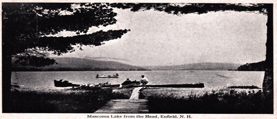
1922
One Hundred Years of the Mascoma Lake Association - In 1923, forty years had passed since the Shakers first permitted the construction of a simple camp on Mascoma Lake on what is now known as Point Comfort. Dozens of other camps and families spread from there around the eastern and southern shore of the lake until there was a community of regular visitors who met each summer to fish, swim, boat and attend dances at the Lakeview Hotel.
In 1923 forty-four founding members met at the Greendale Tea House and founded the Mascoma Lake Improvement Association for “the purpose of conditions around Mascoma Lake”. The association’s nine goals reveal both concerns and commitments. Foremost was preserving the lake’s beauty and tranquility. This included preventing the “erection of signs”, “eradicating unwarranted noise or nuisance”, providing police protection for the cottages and stopping “the dumping of rubbish into the lake and throwing same into the woods behind the cottages or on the roadsides”. The association also pledged to “prevent the lowering of the water level during the summer”, to study “pollution, natural feed for the fish and stocking the lake with fish”.
While the members were seasonal visitors, they also considered the surrounding towns, pledging to “share community interests with the townspeople of Enfield and Lebanon” and “to help promote a beach for the Enfield citizens”. For $1, “All owners of property on the shores of Mascoma and all citizens of Enfield” as well as “others wishing to join” could enjoy the privileges (if not voting) of the association.
The association’s social calendar was busy, with “Dancing at the Pavilion, Tennis, Clambake, Sings and Card Parties”. There were also games of softball and fishing contests and performances by Shaker singers. The educational calendar was full too, with talks on developing recreational facilities (by a former senator), the Shakers, procedures for town meeting and pollution. The association also worked on mosquito and poison ivy control and fire protection. The MLA contributed money to the Enfield Outing Club for its work on Shakoma Beach. It also stocked the lake with fish and organized regular (annual) garbage collection.
Now, one hundred years later, life on the lake has changed. Families no longer spend the entire summer on the lake in camps served only by boat. And they no longer need to create their own amusements. The Lakeview Hotel, formerly on Shaker Blvd., is gone. Cottages have changed hands as families died out or split up. Many of the camps are now year-round homes.
What has not changed is the MLA’s mission, which today is: “To protect Lake Mascoma and its environment, to promote the responsible and sustainable enjoyment of the Lake by all its users, and to educate the public on issues related to these objectives.”
Today, the MLA has an extensive water-quality program. Lakes across the US that do not have the MLA’s milfoil collection and prevention program have seen their waters choked with the invasive plant, ruining the health of the lake and the value of property. Support of the MLA has been vital for loon protection. Likewise, MLA staffs the Lake Host Program, which educates boaters about invasive plants.
The MLA is still open to anyone who cares about the lake (dues are more than $1!). Sign up via the MLA website.
Please join one of the MLA’s summer activities listed below and come along for another century of caring for one of Enfield’s most precious resources.
Back to Top
Enfield’s Shaker Museum Meets the Challenge of a New Century
Enfield’s Shaker Museum Meets the Challenge of a New Century - With the Shaker Museum’s agreement to purchase the site of La Salette, the former Shaker lands on the western shore of Mascoma Lake have come full circle after a century of ownership changes and financial ups and downs.
A murder, (see Enfield’s June 2021 newsletter), a legal judgment and changing social trends slowly shrank the Shaker communities on the western side of Mascoma Lake. In 1923, the Church and North Families put their 1100 acres and 70 buildings on the market. Despite receiving an offer of $100,000 from a New York sporting club, the Shakers preferred to keep their home’s spiritual character and sold the property to the Missionaries of La Salette for $25,000 in 1927.
Over the following decades, the La Salette priests repurposed the buildings of the Shakers’ North and Church families, using them for a seminary, high school and religious retreats. At Christmas, La Salette’s Festival of Lights brightened both the dark nights of Advent and the spirits of Upper Valley residents.
The seminary closed in 1970 and then in 1985 La Salette, itself in straitened financial circumstances, consolidated its activities in the North Family buildings (site of the Christmas show). They sold the rest of their holdings to real estate developers, who developed the Lower Shaker Village houses.
Facing the dire possibility that this beautiful site and piece of heritage might be forgotten, a group of citizens, with the cooperation of the developers gathered enough money to set up a tiny exhibition/museum in the Shakers’ Great Stone Building.
They set up a board of trustees and guided what was eventually named the Enfield Shaker Museum (the “ESM”) through the process of filing for tax exempt status in 1987 and the acquisition of its first building, the Laundry/Dairy building, in 1991. Since then, the ESM has gotten legal title to other buildings and a collection of artifacts that had been on loan. The ESM assisted the state of New Hampshire in its acquisition of 1100 acres of land that is now under permanent conservation and managed by N.H. Fish and Game.
It was more financial trouble, this time on the part of the investors who were in foreclosure, that gave the ESM the opportunity to purchase still more property in 1997. This raised the museum to another level; its holdings grew four times and it owned the beacon of the Enfield Shakers, the monumental Great Stone Dwelling.
Since then, the museum has purchased several other Shaker structures as well as recreating the Shakers’ gardens and presenting a rich program of activities that attract the academic, heritage and local communities. Generous gifts of time and money, particularly from John Hilberg who paid off the museum’s mortgage, allowed restoration to begin.
In December 2022, La Salette’s North American Provincial Council announced that to husband its dwindling resources it would close the Enfield shrine. La Salette and ESM had negotiated a right of first refusal should the property on the west side of Route 4A be sold. But would it be able to manage this?
Once again, economic concerns competed with spiritual ones. La Salette’s home, with its panoramic views and location on a well-travelled road, was an attractive prize for investors. Many Upper Valley residents feared the loss of this open land and the services of the La Salette priests. But the organization honored the Shaker spirit and in June 2023 La Salette agreed to sell its property to the ESM.
The purchase is a challenge for the museum and we will all have to pull together for the $3 million campaign to complete the sale and care for the land and five original Shaker buildings it brings: the former La Salette gift shop, the red brick residence (the Shakers’ Trustees’ Office, two Shaker barns and a wood house, which served as La Salette’s bingo hall and cafeteria.
Now, the Shakers’ lands are reunited under the guiding hand of an institution whose sole purpose is to preserve their legacy. The Shakers’ spiritual heritage rests secure among the hills and on the shore of the lake they loved. Upper Valley residents can look forward to another century of this legacy, along with seminars, harvest festivals and museum visits and—many hope—the Festival of Lights.
Back to Top
The Currier Family in Enfield
The Currier Family in Enfield - In previous newsletters we have talked about Enfield’s architectural legacy. In this newsletter, and perhaps others from time to time, we’ll look at another kind of legacy. These are the people who have contributed to Enfield’s history and growth, many of whose descendants are still active in Enfield today, the Currier family for example. There are so many Curriers in Enfield’s history that it is hard to keep them straight! They have also been here since our town’s earliest days.
The first Curriers to arrive came from South Hampton, NH and settled in East Enfield (now known as Lockehaven). Through marriage and land purchases they eventually spread to Enfield’s four corners.
Four years after Richard Currier settled in East Enfield, he built a tavern in 1787. It was conveniently located on The Old Road to Grafton. The two-story tavern had a central hall, with bars on both sides of the hall, as well as accommodations for overnight guests. The tavern was successful enough that Richard expanded into other businesses, including interests in local mills, and purchased more land. The tavern is currently a private home.
Richard Currier was joined in East Enfield by Nathan Currier, who arrived sometime before 1800. Nathan had a mill that ground grain, sawed boards and made hames (part of a horse collar). Four generations would live in Nathan’s house at the intersection of Oak Hill Road and Grafton Pond Road. His son built the Oak Hill Schoolhouse.
A second Currier in the hospitality business was Richard Warren Currier, who built the Grafton House Hotel in 1840. It was located in Enfield Center, on the Fourth New Hampshire Turnpike (now Route 4A). Until it burned in 1894, it was a successful and popular hostelry.
Another well-known Currier institution in Enfield Center was the F.T. Currier Store, now Proctor’s. Frank Thomas Currier purchased the store from the Purmort estate. In addition to provisions and hardware, F.T. Currier also sold insurance and acted as postmaster. A fire struck the store in 1899, perhaps started by an explosion. Currier saved himself—at the cost of a sprained ankle—by jumping out of a window. While the financial loss of around $6000 was considerable, the biggest loss was all the town records. These had been kept in the store because Currier was the town clerk. The store was rebuilt and Currier went on to, among other things, promote the installation of sidewalks in Enfield Center.
On the other side of town, Jonathan Currier purchased ninety-two acres of land from Jonathan Paddleford in 1789. Jonathan farmed the land, which extended from the Lebanon-Canaan line down to the point on Mascoma Lake known as Currier’s Landing. Jonathan married twice and had two sons and a daughter. When he died in 1848, the land passed to his son Barnard and then remained in the Currier family until 1924.
When Enfield’s economic center shifted to North Enfield, one of the first blocks in the downtown area was built by John Currier. Curriers also invested in some of the new businesses.
Their biggest mark on the area is the Copeland block, which was built by Ira Copeland, who was married to Elsina Currier. Although they lived elsewhere, the couple returned to Enfield in 1857 to care for Elsina’s parents. In 1897 Ira, now widowed, offered the town $10,000 to build a school. After the town turned down Copeland’s donation because it could not agree on its conditions, Copeland purchased a lot on Main Street where he built the Copeland Block.
Currier family members participated in all spheres of town life and were particularly active in the Masons. In 1827, Richard Currier III was one of the founders of the Enfield lodge and its first master. This began a line of Currier Masons that lasted for over one hundred years.
Equally active in Enfield government, there have been numerous Curriers in Enfield government since Daniel Currier became a selectman in 1805. These included at least nine selectmen and a tax collector.
And finally, Currier family members also served their country, in the American Revolution, the Civil War, the Second World War and the Vietnam War.
Back to Top
Home in Enfield
Home in Enfield - With housing on the minds of many here in the Upper Valley, let’s look at some building types that Enfield residents have called home.
Native American Sokoki, Enfield’s earliest residents who lived between the Connecticut and Saco rivers, do not appear to have left traces of any permanent settlements. However, flints and arrowheads found near the head of the lake and the South Family Shaker settlement, along with reports from the 1800s of cleared land, suggest that they camped near the Knox River’s entry into the lake. There, like today’s residents, they would have enjoyed both Mascoma Lake’s fishing and its natural beauty.
Many of Enfield’s early European settlers purchased land sight unseen, knowing little more than that it was thickly forested. Working themselves or with neighbors, they built homes and agricultural buildings as they needed. The home that Jonathan Paddleford built on the land he acquired in 1765 was a log one, which was later supplemented with a grist mill.
Although referred to by a single family’s name, such as the Paddleford homestead, several generations and family groups lived together in these homes. They cannot truly be called “single family” in the sense of the single, detached building inhabited by a nuclear family, which is the model typical of the United States today.
These early houses were typical of rural New England and reflected the needs and resources of the time. They were built from the abundant local wood and faced with clapboards. They had simple gable roofs and limited windows, which made them suitable for New Hampshire winters and allowed homesteaders to build them. Their rooms served several purposes; cooking, socializing and sleeping might all happen in the same space. Over the years, these residences grew as their owners put on additions that meander back from the original core and occasionally join up with the barn.
The Shakers lived communally and used “family” in a collective sense, referring to wider groups that included both biological families and fellow Shakers, e.g. the North, Church and South families. The largest and most impressive Shaker residence is the Great Stone Dwelling, which was completed in 1841 and had separate sections for men and women.
Whether Shaker believers or not, Enfield residents tended to live in multi-generational households.
As the Shaker community shrank, their buildings were moved and repurposed, including the Hacienda and another multi-family dwelling on Wells Street. (See Enfield Newsletter of September, 2021).
The shift of Enfield’s population and economic center to what is now Main Street introduced new types of residences. Mill owners and executives built larger homes on Shaker Hill Road and Wells Street in the Queen Anne style, popular in the late Victorian era. In contrast to the settlers’ first homes, their size and architectural flourishes, such as bay windows or multi-gabled roofs, called for professional building skills. They also incorporated new materials, such as plate glass windows.
An influx of workers for the mills called for more housing in town. On Pillsbury Street, named for the carpenter Joseph Pillsbury, lots for tenements to house millworkers were laid out in 1902. In addition to the multi-family units known today as the “Mill Houses” several duplexes were also built on Shedd Street. Shedd Street was sometimes called “Finn Street” after the many Finnish workers who moved there.
The Shakers also had a residential presence downtown in addition to the Shaker buildings on Wells Street. One of the most prominent buildings at the intersection of Main Street and Shaker Hill Road was the Shaker boarding house, which provided rooms for workers at the Shakers’ mills and businesses.
None of this development had any legal regulation until Enfield’s first zoning ordinance was introduced in 1991. This plan designated six specific areas for conservation, business, strictly residential as well as mixed residential/commercial/agricultural use. With the ordinance, the town also made specific provisions about the size of lots and the placement of buildings on them.
The goal of the ordinance is to guide development in Enfield, to balance individual and community needs, conserve the town’s residential character and protect its tranquility and wildlife.
Enfield’s housing needs and types continue to cycle as they have since Native Americans camped on Mascoma’s shore. Recent zoning changes reflect the town’s current demands, while alluding to the past. A zoning adjustment at 71 Main Street will bring a new multi-family residential building into the historical setting of the former Shaker boarding house. A recent modification to the zoning ordinance will permit accessory dwelling units (“ADUs”). Often referred to as “granny flats”, these small units continue the multi-generational arrangements typical of Enfield homes in the past.
Back to Top
The “Angel life” and the Demise of Enfield’s Shakers
The "Angel life" and the Demise of Enfield's Shakers - How many Enfield residents have had this response when telling people about the Shaker part of our history? “Oh of course the Shakers died off” they often say, “with the separation of sexes how could they reproduce?”
There are several issues with this idea: 1) Is it true? 2) The idea that birth replacement is the only way to keep a movement or idea alive. 3) Like any other historical fact—and the demise of the Shakers is a fact—the causes are many and complex. In addition, as that popular idea suggests, the things that cause something’s end are often embedded in its beginning.
Let’s start chronologically, or with Number 4. From the beginning, Mother Ann Lee, whose ideas became the basis of the Shaker communities, insisted on celibacy. Perhaps influenced by Lee’s own sad experience of losing four children and a marital break-up, Lee and her followers believed that salvation depended on suppressing carnal desire. Living the “Angel life” was what Henry Cumings, an Enfield Shaker elder, called the principle in a 1906 article in the Enfield Advocate. “No marrying or giving in marriage, husbands and wives to renounce that relation to each other and to live as brother and sister.”
Number 2. Shaker communities managed to increase, despite the rules about celibacy. Lee arrived in America with eight followers in 1774 and at the movement’s peak in the 1840s there were around 4000 or 5000 members and nineteen (major) communities. After all, having children is not the only way for communities of belief to grow, nor is it a guarantee of staying power. Catholicism has declined in the U.S. and Europe notwithstanding its encouragement of procreation.
Numbers 1 and 3 are intertwined. The Shakers were part of the second “Great Awakening,” between the late eighteenth century and the mid-nineteenth century, a period distinguished by spiritual ferment and religious innovation. Hundreds of groups in the U.S. sought new paths to redemption or social change or to prepare America for the second coming of Christ. Many created communities, usually rural, where believers could live and work together. There was a wide spectrum of beliefs and practices, from the Shakers’ celibacy to the sexual freedom and partner exchanges practiced in the Oneida communities.
Number 3. Rapid industrialization, increasing urbanization and huge influxes of immigrants from traditionally Catholic countries diluted the influence of the Second Awakening, which affected all the Shaker communities. In Enfield and elsewhere there were generational changes. When older leaders died off, their younger replacements introduced new practices and ideas that caused internal conflicts and defections. Some adherents were not terribly committed to begin with, such as the “winter Shakers,” whose nickname reveals their motives for joining in New England’s harshest season. The Civil War took young men away. Railroads and faster communications made it harder to stay isolated and brought the outside world’s temptations closer. In addition, the cities who had sent their orphans to rural areas began building their own orphanages.
In Enfield, a series of financial reverses and poor management struck repeated blows.
By the late nineteenth century, almost all the Utopian settlements similar to the Shakers had died out, including the Oneida movement, even though sexual freedom was a central part of its practice.
Back to Top
Shady Dealings in Enfield
Shady Dealings in Enfield - Alas, business has not always been as honest and transparent as it should be in Enfield.
Several cases of shady dealings have blighted our town.
In fact, there were shady dealings connected not only with Enfield’s beginnings, but also the state of New Hampshire itself, which was in a dispute over territory with Massachusetts that was only resolved in 1738. As a result of this litigation and its settlement (which also involved Spain; it’s complicated), Britain’s King George III appointed Benning Wentworth of Portsmouth governor of New Hampshire in 1741.
Wentworth feathered his nest selling parcels of the land under his jurisdiction to friends and speculators. He also assembled thousands of acres for himself, including land in Enfield. The land was sold under a charter, whose conditions stipulated that the land be cleared within five years. When many purchasers proved unable to clear their heavily-forested lots within this time, they ended up forfeiting their property. Their property was then resold under a new charter to a group led by physician Anthony Relhan. This dubious transaction created a raft of lawsuits, known as the “War of the Charters”. It would take until 1779 to settle the disputes.
With ownership issues cleared up, settlement and business took off in Enfield. One of the people who came to the promising Upper Valley from Connecticut was Jacob Choate, a veteran of the Revolutionary War. Choate was a larger-than-life character, a former sea captain known as a bully. Choate assembled a sizable amount of land and eventually moved to Shaker Hill. Jacob Choate’s brother-in-law found a purse containing another man’s money. Instead of returning it to its rightful owner, he gave it to Choate, who kept it. The owner sued Choate. In his effort to hide his property to evade the legal penalty for this, Choate made a shady deal to sell his land to a third party, perhaps with the intent of repurchasing it later. However, some of the land he sold did not actually belong to him. Only after the land had changed hands several times was the fraud discovered. As a result, Choate’s land was confiscated, along with his horse. Choate stole the horse back and fled Enfield for Canada...
A third example of bad faith in Enfield involved the Shakers. After Shaker leader Caleb Dyer was murdered in 1863 (for more information about Dyer see https://www.enfield.nh.us/heritage-commission/pages/know-your-town - anchor_Caleb_Dyer_Lane), Shaker-run businesses were transferred to other owners. Dyer had not kept written records of his dealings, a failure that allowed new owners of Shaker businesses to create false claims for money they said the Shakers owed them. Such written records as there were, were falsified or tampered with. Litigation over the fraud lasted twenty years and the Shakers lost around $20,000. This financial blow combined with poor record keeping and inadequate legal representation proved insurmountable for the Shakers, and an important cause of their ultimate demise.
Back to Top
A New Chapter at the Heritage Commission
A New Chapter at the Heritage Commission - Enfield’s Heritage Commission faces the resignation of longtime chair, Meredith Smith with great sadness.
Meredith’s commitment to historic preservation dates from long before she and husband Doug Smith moved to Enfield in 2000. Growing up in Rhode Island, she was surrounded by family and friends who changed the face of Providence.
Upon moving north, Meredith and Doug immediately understood the value of Enfield’s historic buildings and how they could restore Enfield’s vitality. Barely a year after settling into the former Livingstone Lodge, the Smiths joined other Enfield residents to create the Enfield Village Association; Doug became EVA’s first president. They were also instrumental in getting Enfield recognition by NH Main Street, a program of the National Trust for Historic Preservation, whose mission is restoring economic vitality and celebrating the historic character of America’s downtowns. On learning how a heritage commission could improve Enfield’s chances for Main Street recognition, the Smiths wrote a petitioned warrant article to create a Heritage Commission and got the necessary signatures for its inclusion in town meeting. The commission was voted in at the 2001 town meeting.
Since the successful bid to join the Main Street program, the Heritage Commission has been one of the town’s three land use boards. Smith has been the commission’s chair for that entire time.
Enfield can thank Meredith for leadership that brought significant grants to Enfield. Together with New Hampshire’s Department of Transportation and EVA, the Heritage Commission has installed several historic markers. Successful grant applications written by Meredith for New Hampshire’s Conservation License Plates—“Mooseplate Grants”—have paid for the restoration of the grand drape for Whitney Hall and as well as stabilizing the Enfield Center Town House.
Smith was quick to grasp how a park on the site of a former motel could enhance Enfield. Mascoma Lakeside Park was a direct outgrowth of the Heritage Commission’s mission to protect and promote historic and esthetic resources that are significant to our community, be they natural, built or cultural. Smith’s tireless fundraising and coordination of the numerous agencies and stakeholders connected with the property made the park, which is now widely admired and used in the Upper Valley.
Smith’s “biggest” accomplishment during her decades dedicated to Enfield’s heritage is the creation of one of the largest National Historic Register Districts in NH, the Enfield Village district. In addition, Smith’s leadership—and the work of Andrew Cushing—also led the Enfield Center Town House’s listing on the register. Most recently, the passage of the Local Historic District for Enfield Center at last year’s Town Meeting was another important Heritage Commission achievement.
Smith’s tenure has had many challenges familiar to heritage preservation professionals everywhere. These include the need for constant education about how heritage commissions create community pride, upgrade property values, promote economic development through historic preservation, and preserve important historic buildings and sites. There is also the constant work of undoing persistent myths about the limits of preservation.
The Heritage Commission will continue Meredith’s work with Enfield’s Planning Board and administration to make the most of our town’s historic assets.
As Smith says “The Enfield Shaker Museum’s recent acquisition of the North Family property (La Salette) is a new opportunity for the town to work collectively with the Museum and Heritage Commission to ensure the Museum receives National Historic Landmark status.
This indeed will place Enfield on the map as an important tourism destination. Much work to be done!”
Back to Top
Methodist Hill
Methodist Hill - In 2021 the town of Enfield acquired a plot of around 100 acres on Methodist Hill in compensation for unpaid taxes.
Given the potential of this land, the town created a committee to study its potential uses. On January 8, 2024, the committee presented its recommendations to the Select Board.
While the town considers the fate of the property, let’s look at Methodist Hill and this part of Enfield, which nestles in the corner where the town lines of Lebanon, Plainfield and Enfield all meet.
Officially known as West Enfield, this southwestern corner of Enfield has always felt remote. In Enfield’s earliest days, it was almost the polar opposite of the town’s population concentration, centered around Lockehaven.
In 1968, the route of Interstate 89 created a physical separation of the area between today’s business and administrative center in downtown Enfield and the area between Whaleback Mountain and the Enfield/Lebanon town line.
Over the years, southwestern Enfield has gone by several names: Over the Mountain, Fox Hollow and Montcalm as well as the numbers of the I-89 exits—15 and 16.
Various roads serviced the area, including Methodist Hill Road, Smith Pond Road, Potato Road, Stoney Brook Road and NH Route 10, most of which have been closed or reconfigured since the arrival of I-89.
The town-owned plot on Methodist Hill, which is mostly wooded, was once cleared for agricultural use. An extensive network of stone walls and traces of building foundations are reminders that the area had a life of its own, despite its distance from more populated areas. The name “Methodist Hill” refers to the active community of Methodists who settled the area. In 1834, local residents built Union Church, which was also home to a congregation of Free Will Baptists. Worshippers came from all the surrounding towns, including Grantham. The congregation dwindled, leaving the building unused. In 1906 it was moved and converted to a dwelling, which burned in 1915. The church was painted green and had a steeple topped with a ball, but no bell.
In addition to the church, there was a parsonage and a burying ground located about 700 feet from the church. Methodist Hill Cemetery, which is technically part of Plainfield, contains the graves of four Revolutionary War veterans and early Enfield settlers.
Methodist Hill had a school and its district, which was created in 1785, was known as “Over the Mountain”.
At the Select Board’s meeting of January 8th, the Methodist Hill Committee recommended that the town make part of the land available for residential construction. The town would retain another part for a conservation area and nature trails, where everyone could enjoy this quiet and historic part of our town.
Back to Top
Native Americans - Enfield
Native Americans - Enfield - Long before people came to enjoy the water and scenery of our area by car on I-89 or carriage via the Fourth New Hampshire Turnpike, Native Americans stopped on the shores of Mascoma Lake and River. 11,000 years ago, Native Americans, like the later Europeans settlers who followed them, travelled and lived along water routes that linked the Connecticut River with southern villages and the Atlantic coast. In East Lebanon, where rapids interrupted navigation, indigenous travelers would sink their canoes and proceed on foot taking the Maskwamok-Aguadakan trail along Mascoma Lake and the Indian River to The Weirs in Laconia.
These travelers belonged to the Abenaki language group, which dominated New Hampshire and consisted of several bands including the Penacook, Winnipesaukee, Pigwacket, Sokoki, Cowasuck and Ossipee bands. Sokoki sachem “Chief” Mascoma negotiated treaties on behalf of his people. Native American settlement in the Enfield area appears to have been transitory or seasonal. Any dwellings would have been semi-permanent and the preferred location for them was flat areas near water.
In fact, the material traces of indigenous people’s presence in Enfield come from the beachy, flat ends of Lake Mascoma, where the Knox and the Mascoma rivers enter the lake. In 1951, stone flakes and pottery fragments were found on the water’s edge near what is now Lakeside Park. A woman living near the current park found “projectile points” in her garden in 1975. During preparation for building Mascoma Lakeside Park, additional stone flakes and pottery (European) were found in test pits.
While living off the bounty of local waters and woods, New Hampshire’s Native Americans were largely agricultural. They cultivated the “three sisters”, corn, beans and squash, as well as sunflowers, Jerusalem artichokes, ground cherry and tobacco. For other goods, they traded with colonists. However, by the time European settlers moved into the Enfield area, the population of the Abenaki in New Hampshire was severely reduced. Epidemics in 1615 and 1620, conflicts with Mohawks and the newly arrived colonists and intermarriage diminished the population. An ongoing conflict with the Iroquois league left up to 75% dead, while northward migration further emptied our area of indigenous people.
Today, there are fewer than 1,000 Abenaki in New Hampshire; few of whom speak the language. New Hampshire does not have any tribes recognized by the federal Bureau of Indian Affairs.
For more information on Enfield’s first inhabitants, visit the seasonally open Mt. Kearsarge Indian Museum. https://www.indianmuseum.org/visit
Back to Top
Railroad House
Railroad House - In the March 2024 “Know your Town”, the Heritage Commission’s section of the Enfield Newsletter, we mentioned Native American artifacts found during the archaeological survey done before the work for Lakeside Park in 2002.
Along with the Native American stone flakes discussed in the previous newsletter, archaeologists found numerous fragments of white and yellow pottery and several types of nails.
The biggest surprise, however, was a group of granite blocks set into the ground forming a “stone lined cellarhole”. Now covered with vegetation—poison ivy!—they are all that is left of a building of 30 by 21.4 feet.
To judge from the types of pottery shards and nails found nearby, this structure was built between the early nineteenth century and the 1870s or 1880s. Two maps, one from 1860 (Walling map) and one from 1892 (Hurd map), suggest these are the remains of a “Railroad Company House” located between the train tracks and Lake Mascoma’s shoreline.
When the Northern Railroad that connected Concord with White River Junction was built in 1847, it was divided into sections named for eleven towns the 69 miles of track passed through; Boscawen, Andover, Enfield, East Lebanon (later renamed Mascoma) etc.
Each section had a variety of buildings, including passenger stations and freight warehouses, as well as housing for the men who built and later maintained the railroad. Many of the Irish immigrants who came to work on its construction ended up staying to take care of the railroad, eventually integrating into their new communities.
Considering the fragments of chamber pots, bottles and china found nearby and its size, the cellar in Lakeside Park was a “section house”, one of the three listed in a 1914 survey of the Northern Railroad.
There were two kinds of section houses, according to an 1893 building manual. One type housed rail-workers’ families, while the second was for men needed to handle emergencies and provide constant care for the railroad’s numerous bridges and track. Section houses were typically “frame structures, roofed with shingles or tin, and sheathed on the outside with upright boards or horizontal weather-boarding”; they were usually influenced by local styles or architecture. The sample plan in this manual is roughly the size of Enfield’s building.
The Enfield Railroad House is only one of two such presently known archaeological sites in New Hampshire.
According to the archeologists who uncovered it, the remains of the Railroad House in Lakeside Park could be listed on the National Register of Historic Places.
Such railroad houses have not been deeply researched in New Hampshire. More study of the one in our town could tell us much about the building itself as well as the evolution of the transportation system that drove Enfield’s development. More research would also illuminate the “lifeways of men and women who operated the railroad”; men and women whose descendants may live among us today.